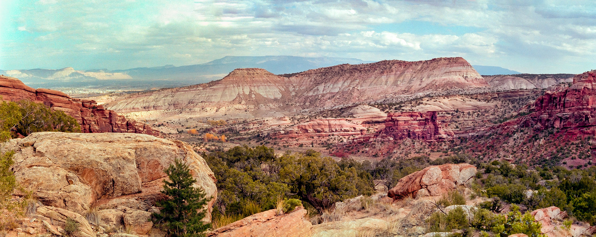
View from No Thoroughfare Canyon looking back toward the East entrance of the park. A portion of Grand Junction can be seen in the upper left of the image.
Low clouds descend from the Continental Divide into Hall Valley. The head of the valley, pictured here, contains a few public campgrounds, Missouri and Whale Mines, and popular trails to Whale Peak ( 13,078 feet / 3.986 meters), Teller Mountain (12,615 feet / 3,845 meters) Handcart Peak (12,518 feet / 3,815 meters), Webster Pass (12,096 feet / 3,687 meters), Red Cone (12,801 feet / 3,902 meters), and several unamed summits bewteen 12,000 and 13,000 feet ( 3,658 and 3,962 meters).
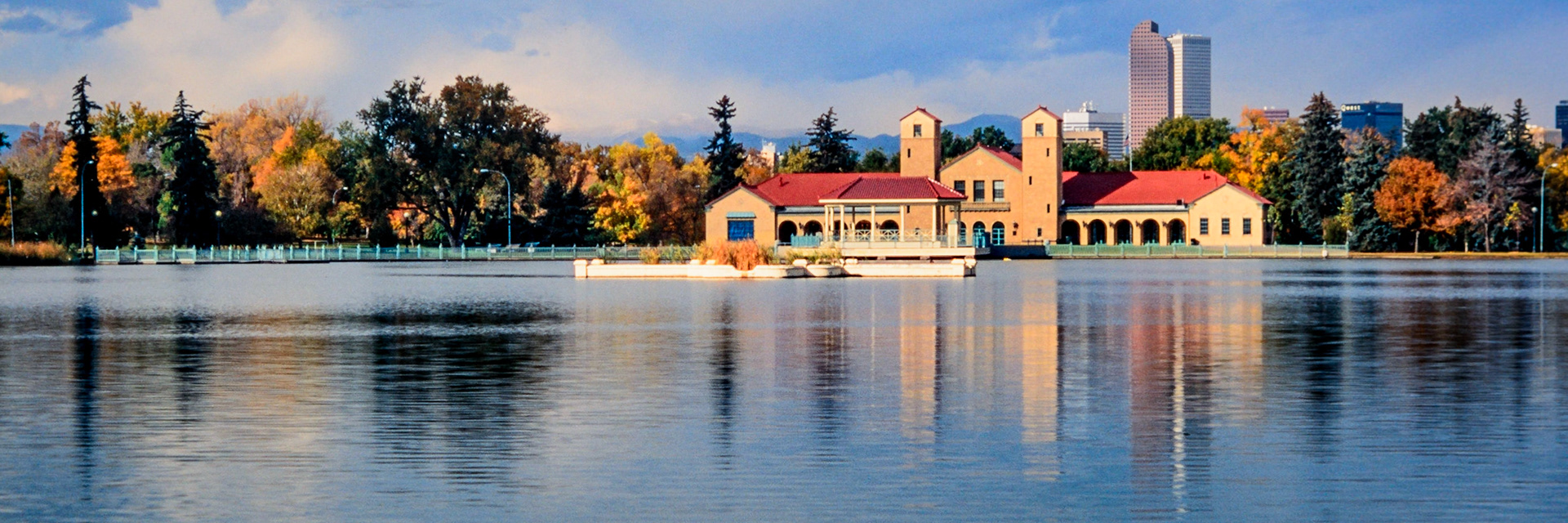
City Park, one of the oldest public spaces in Denver, was designed and built before the turn of the twentieth century, and the park is currently home to the Denver Zoo and the Denver Museum of Nature and Science. The loop around Ferril Lake provides lovely views of the trees around the lake. Captured just after sunrise, the Boathouse, Pavilion, Prismatic Fountain, colorful trees, and two of Denver’s tallest buildings are reflected in the calm water of the lake. A faint Mount Blue Sky (formerly Mt. Evans) , somewhat obscured by the clouds, may be seen in the skyline above the trees immediately to the left of the boathouse. (Unable to confirm the name of the mountain located between the two towers of the boathouse.)
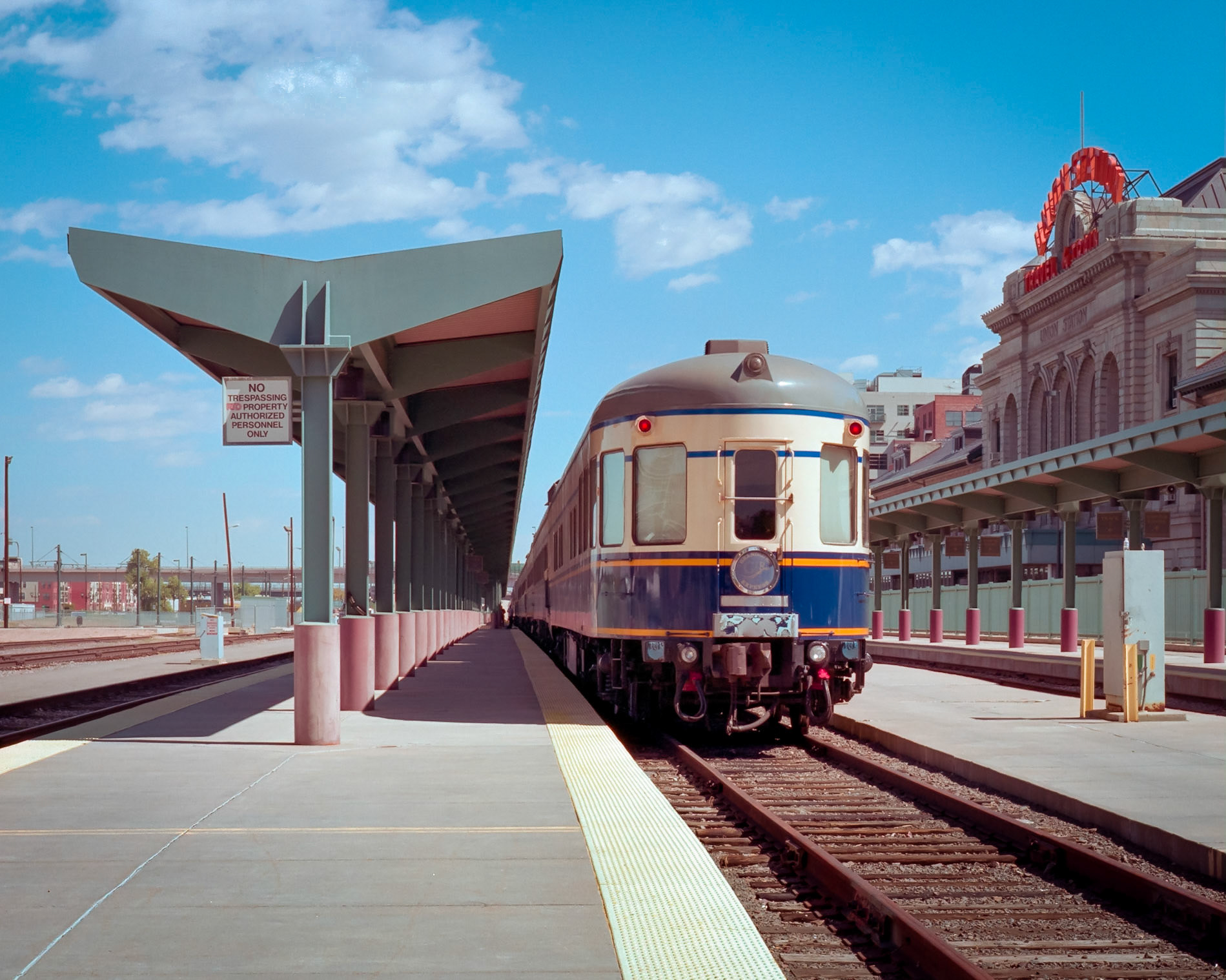
The California Zephyr, ready for boarding and Eastward-bound, sits on a track alongside the Union Station in Denver Colorado. With a familiar orange “Union Station, Travel by Train” sign on both the railyard and public entrance sides advertising its primary purpose, the great hall, which was built in 1914, still functions as ticketing and check-in location for Amtrak. The site is now owned by RTD Denver, and it underwent a complete renovation in 2012 (about five years after this photo was made) as a transit oriented center for buses, light rail, and passenger trains. The remodeled Union Station complex also hosts a hotel, restaurants, and retailers serving both travelers and the general public.
My father had many facets, but one thing he always enjoyed was puttering with found objects. This tree was one of the last pieces he made before he died, and he gave it to me as a gift.
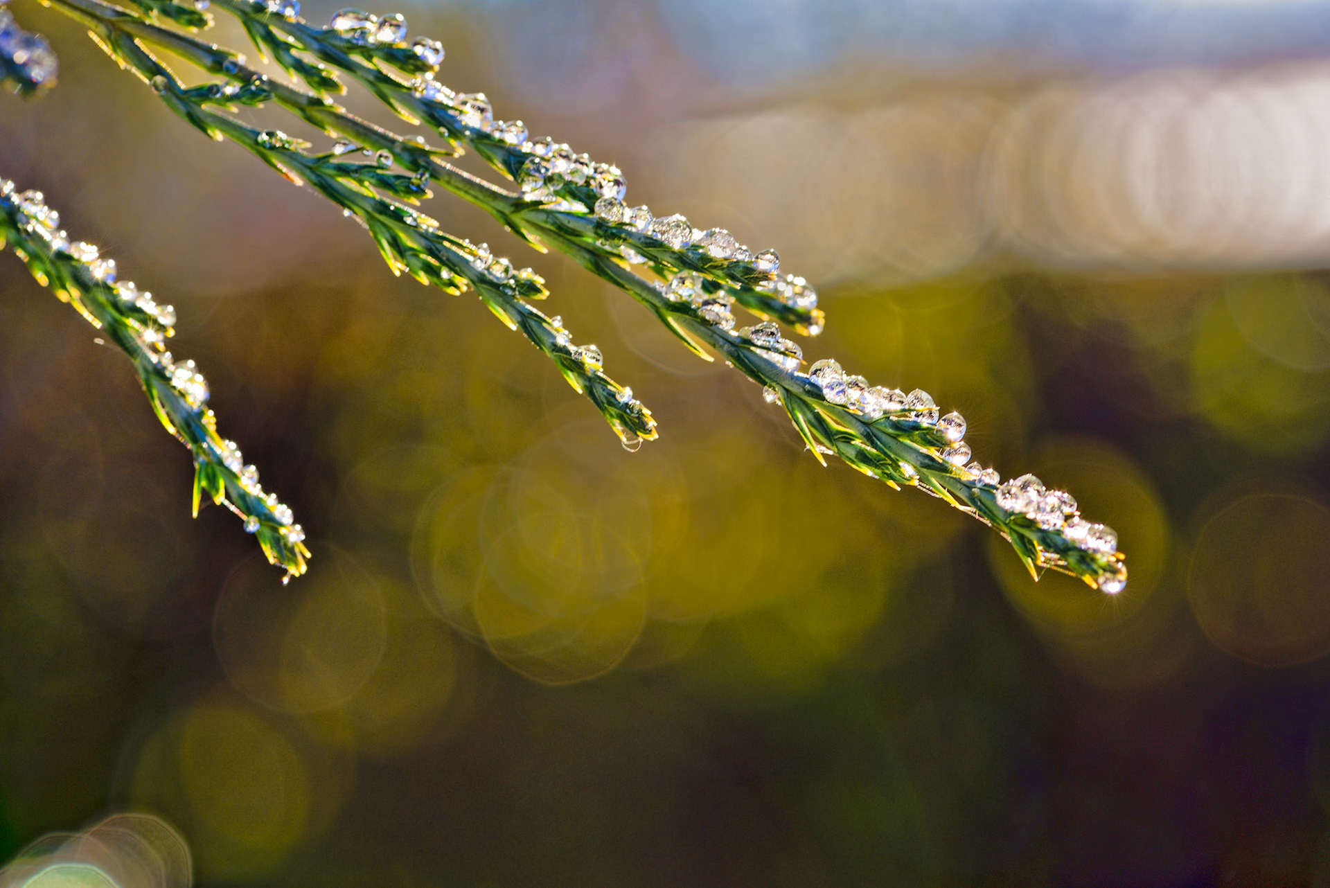
This juniper in my backyard was magically transformed by last night's drizzling rain, freezing cold, and the rising sun.
Decided to try my hand at a maiking a long exposure (30 seconds) photo on a moonless night using only the light from an LED flashlight for illumination. This was the fifth attempt. You can see a portion of a night sky and a house lit by a street light if you look closely in the upper-third of the photo.
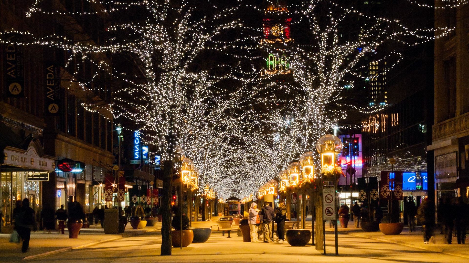
Nighttime shoppers, casual strollers, and friends congregate along the brightly decorated trees along the 16th Street Mall in downtown Denver, Colorado.
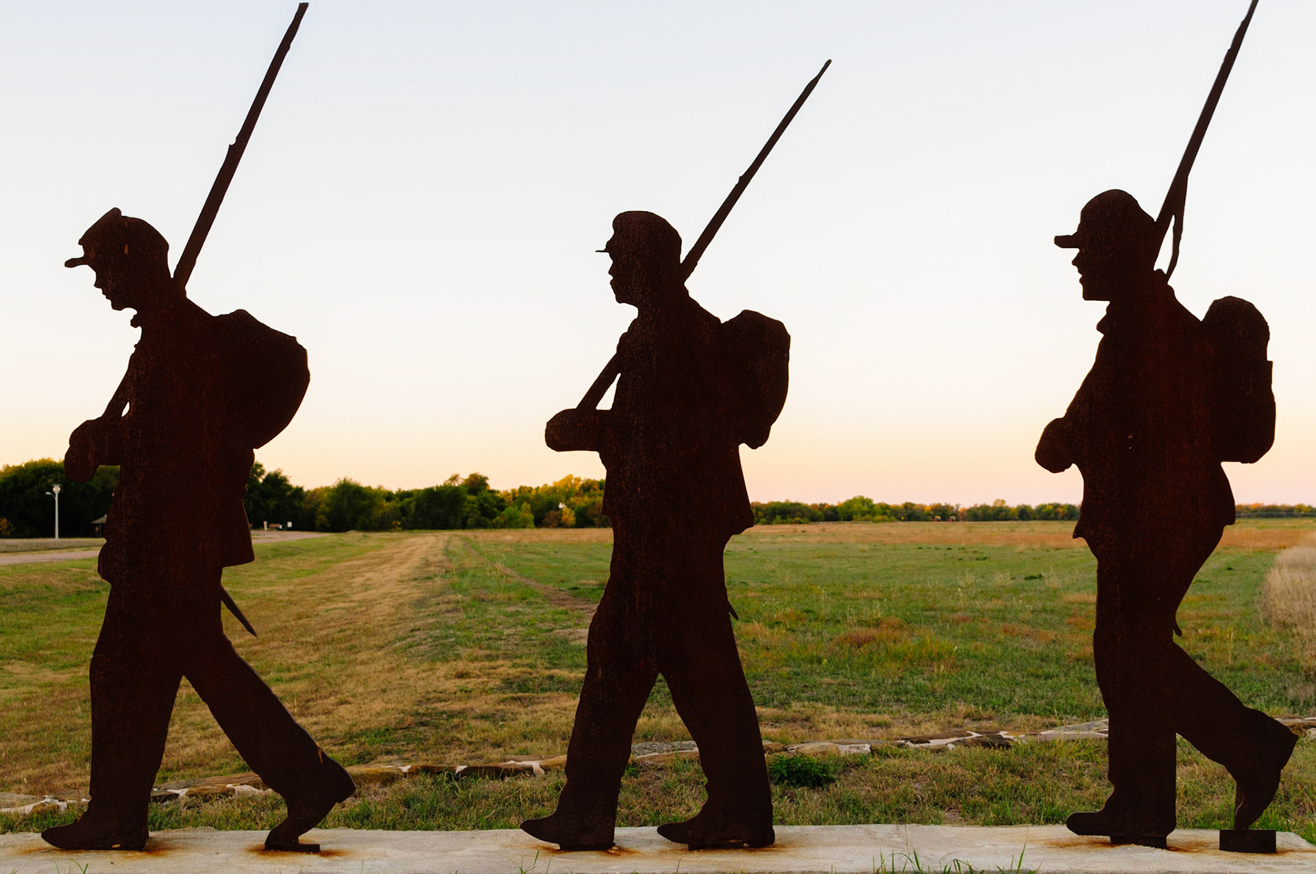
Fort Larned was established in 1859 and situated directly on the “Dry Route” of the Sana Fe trail. The fort was initially staffed by the officers and men of the 1st U.S. Cavalry and the 2nd U.S. Infantry, and subsequently, the 2nd U.S. Dragoons in 1860. The fort, which is currently managed by the National Park Service (NPS) as a National Historic Site (NHS), became known as the “Guardian of The Santa Fe Trail”. The steel plate sculpture pictured here stands as monument at the park entrance.
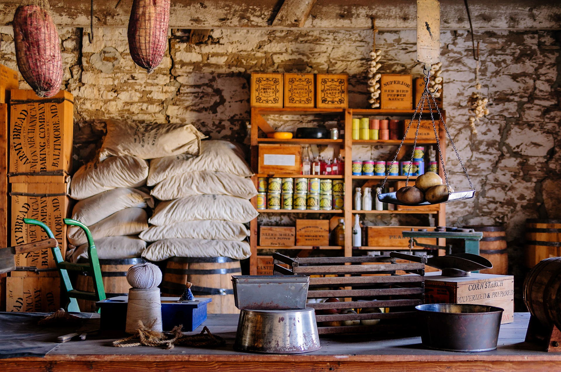
The fort's Quartermaster used stores like this to supply items necessary for the men assigned to the fort to carry out their day-to-day duties. Fort Larned NHS is managed by the National Park Service and is located along the Santa Fe Trail and near the City of Larned, Kansas.
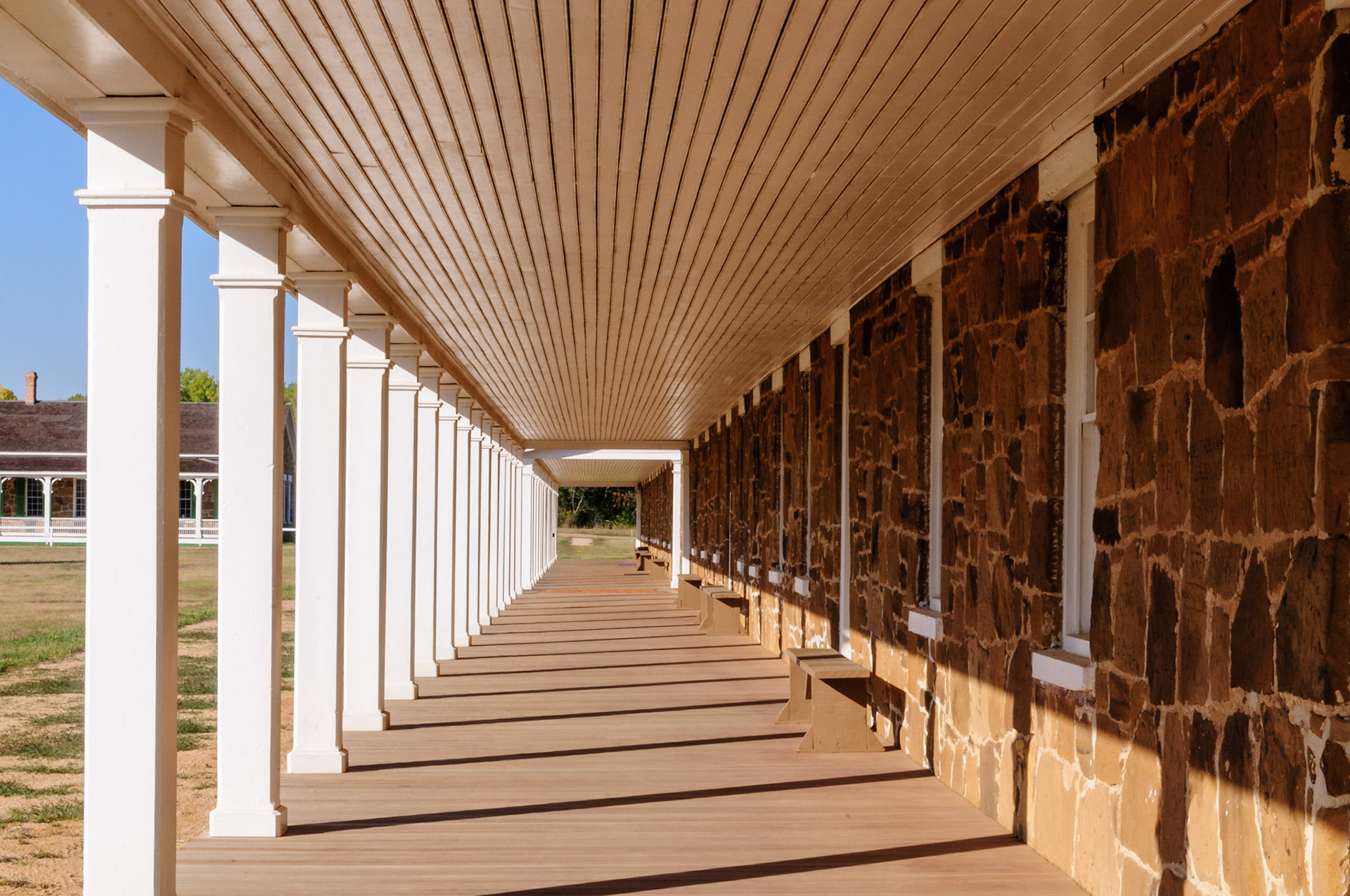
The rising sun casts shadows on the portico of the enlisted men's barracks located on the Northwest side of the parade grounds at the Fort Larned National Historic Site, which is located along the Santa Fe Trail and near the City of Larned, Kansas. Officers' Quarters are seen in the background at center-left of the photograph.
A tree near top of once was a black powder cache at Fort Donelson probably benefitted from whatever spilled from the kegs and seeped into the ground. The fort is located on a National Battlefield site and is managed by the National Park Service.
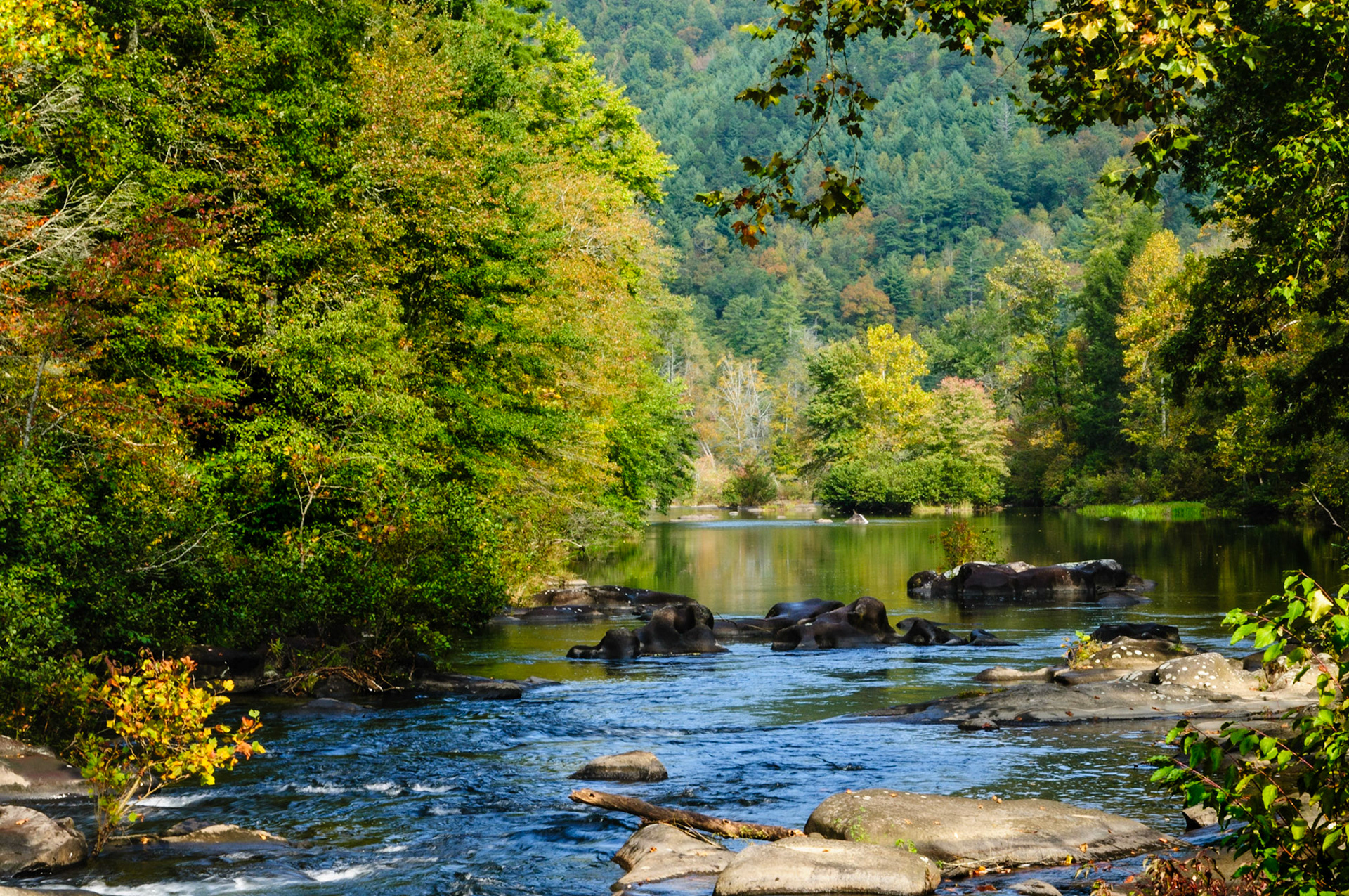
There was this little store, which I believe was in Tennessee and before the Tail of The Dragon ended at Deals Gap, where I was rewarded with this beautiful sight after the store’s owner granted me permission to explore around the property surrounding it. I believe what you’re looking at is a small portion of Cooper Camp Branch on its way to the Little Tennessee River.
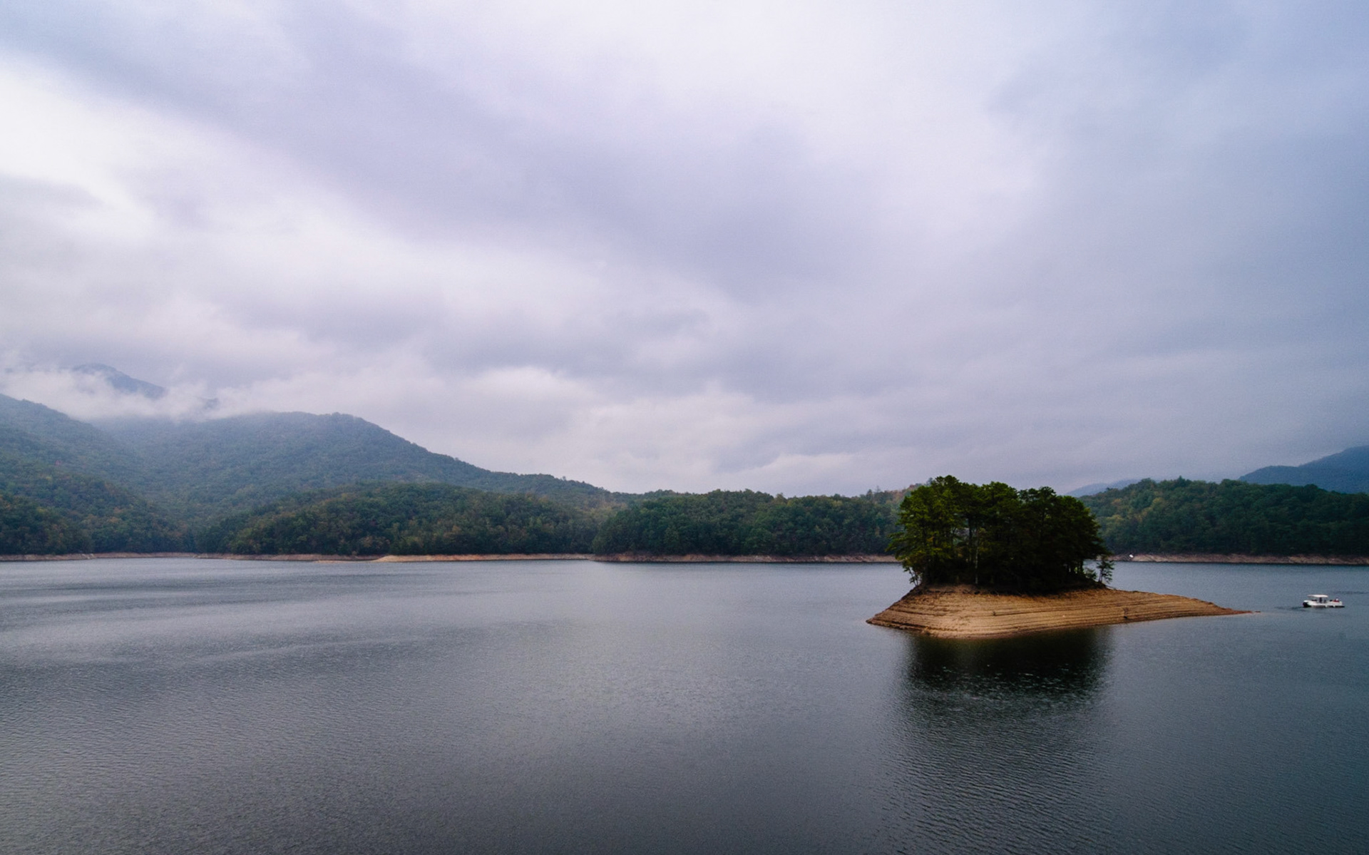
Fontana Lake is a 10,230 acre (4,140 ha) lake created by the Fontana Dam, which is located in Swain and Graham Counties on the Little Tennessee River in North Carolina, and it impounds 1,443,000 acre feet (1.780 km³) of water. This photo was made from the top of the dam when the lake was at a low pool. A portion of the southwestern boundary of the Great Smoky Mountains National Park is pictured here, and the Appalachian Trail crosses the top of the dam.
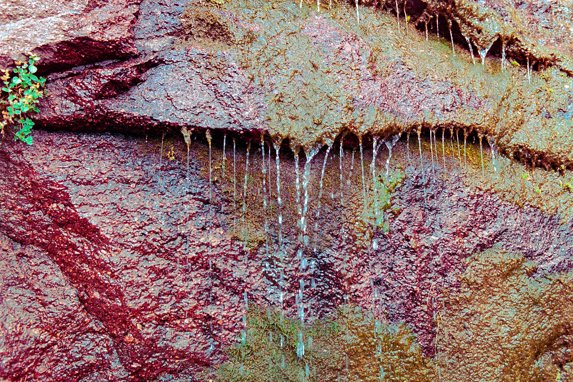
These interesting colors in the wet rock caught my eye while traveling Tomboy Road on the way to Savage Basin and Imogene Pass from Telluride, Colorado.
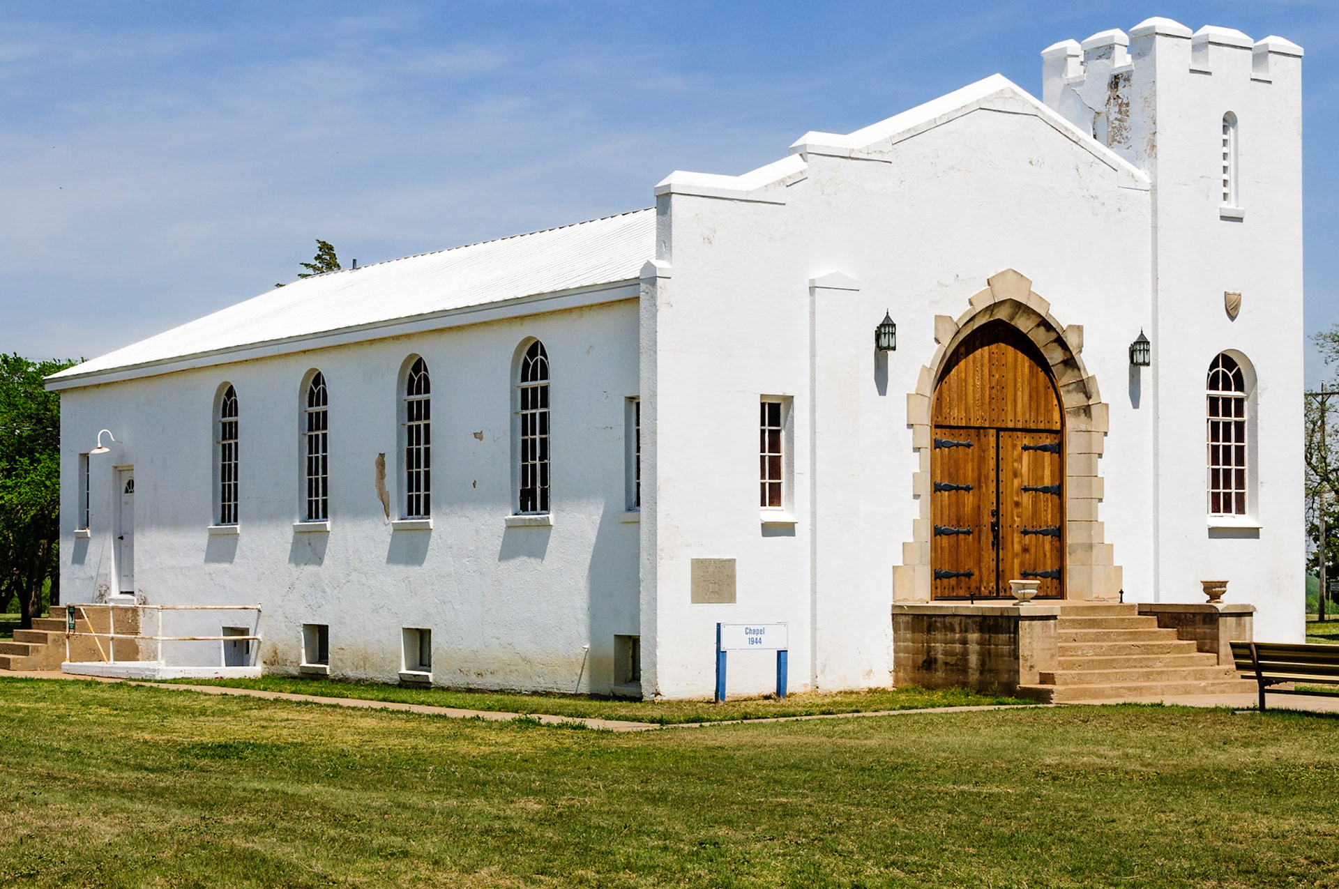
Fort Reno, named after an American General who died during the Civil War, is located near Oklahoma City and adjacent to El Reno and Historic Route 66. For almost seventy-five years it served as a military post during the Indian Nation relocation, assisted with the transition from Indian Territory to the State of Oklahoma, was used as a remount station that provided horses and mules to the US Army, provided support for the (WWII) war effort, and finally as internment camp for German and Italian prisoners of war. This Post Chapel, which is still used today for wedding ceremonies and so forth, was contructed in 1944 by German prisoners of war.
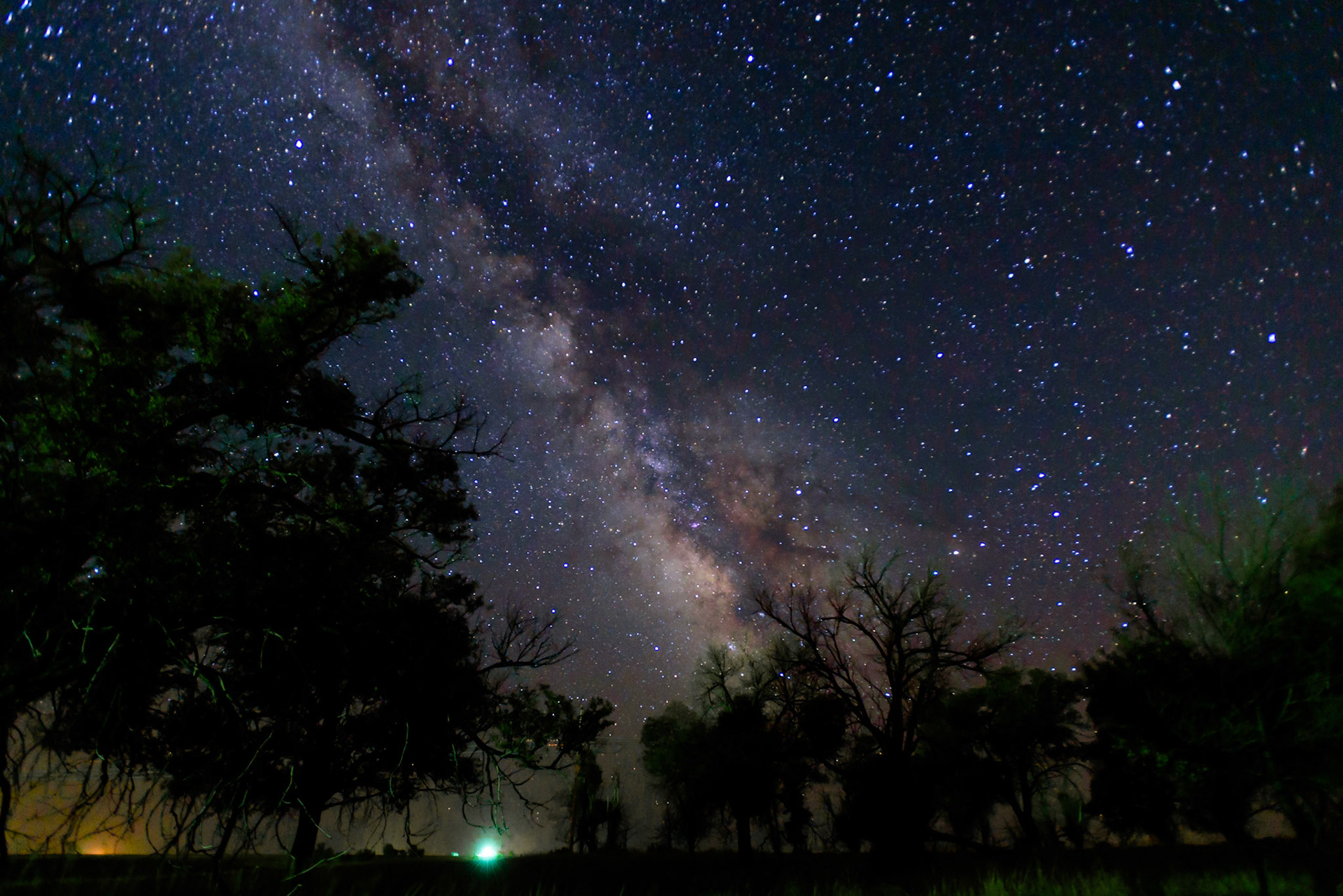
Dark skies for dramatic captures of the Milky Way and its Galactic Center exist on the eastern plains of Colorado, provided one stays away from some of its rural population centers. This photograph was made near Cope, Colorado, which is in a Class 2 (typically truly dark sky) area on the Bortle Scale. Light pollution from Stratton and Bethune, Colorado, which are located more than 40 miles (64 km) from this site, appears in the lower left of the photo. Light from a nearby farm highlights portions of the foreground, and light from another farm is seen as a bright glow on the horizon near the center at the bottom of the photo.
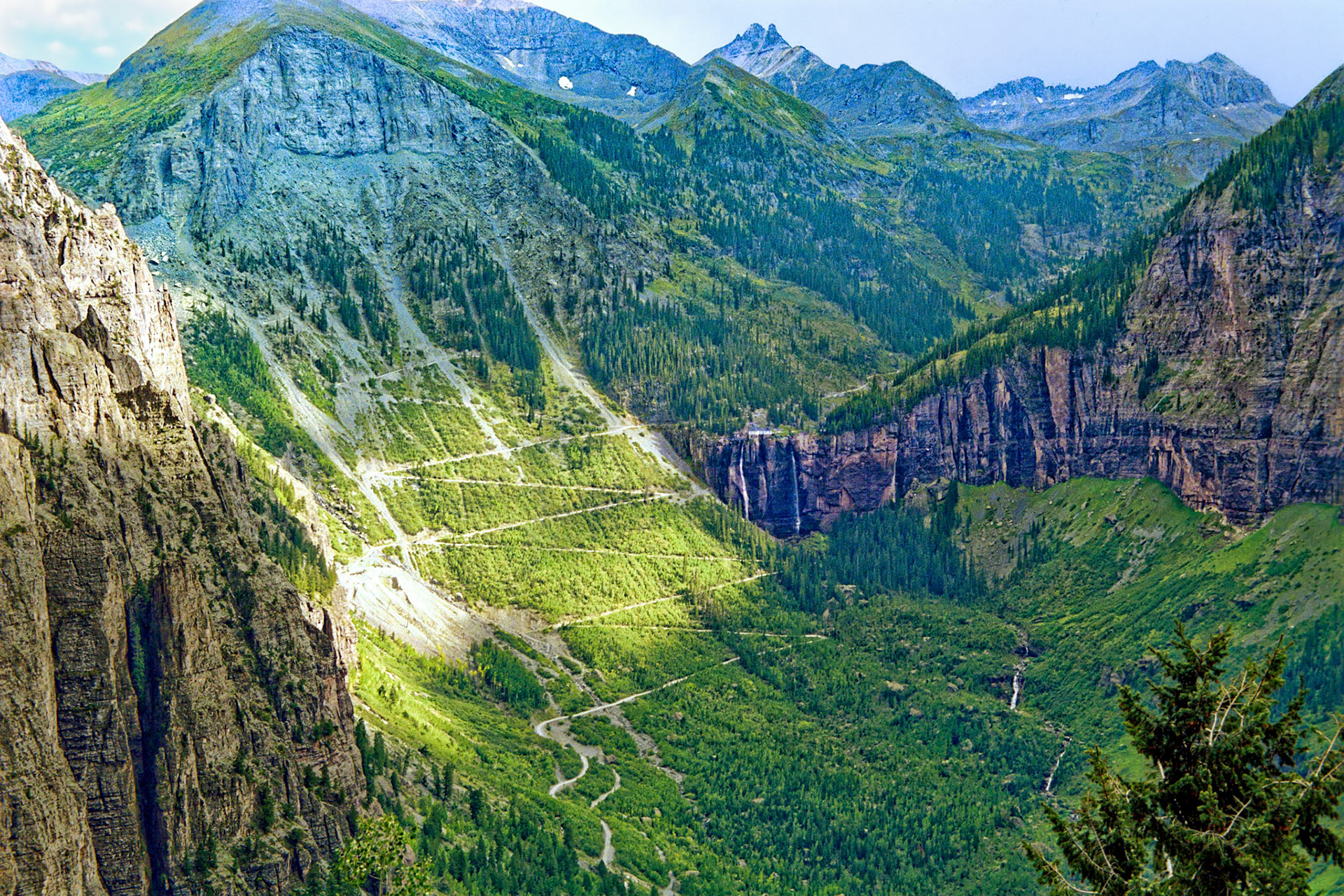
Sunlight pierces some clouds and highlights a road that switches back and forth while moving up the Ingram Peak (12,552 feet or 3,826 meters) massif. Near the center of the photo and just to the right of the switchbacks is Bridal Veil Falls, which are situated at 10,279 feet or 3,133 meters above sea level and at the head of a box canyon above Telluride, Colorado. Looking South-Southeast, this photo was taken from a vantage point near tree line on Tomboy Road, and it is about two miles (more than 3 kilometers) across the valley to the falls.
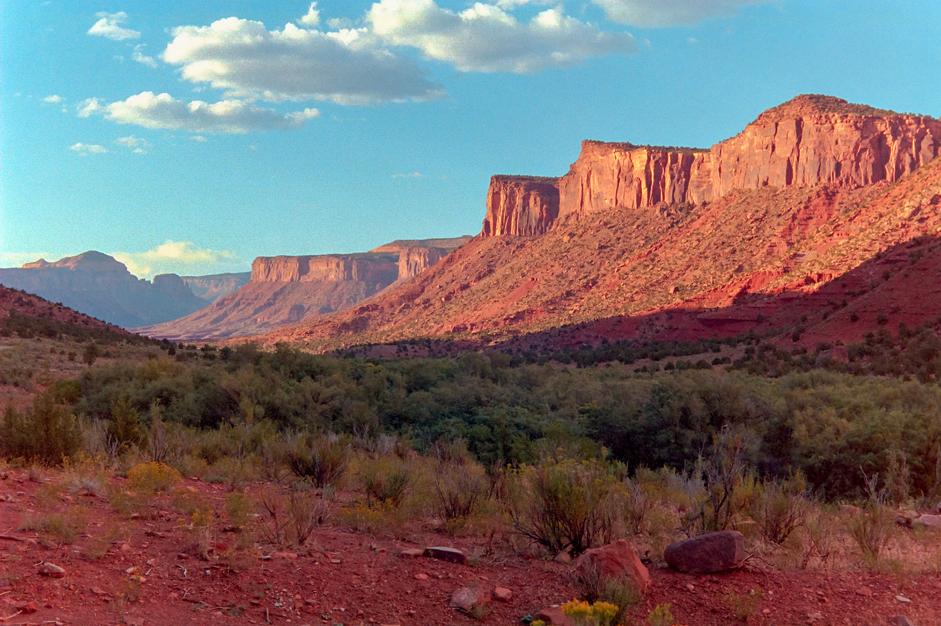
Late afternoon sun creates long shadows and brightly lights the cliffs along the Unaweep-Tabeguache Scenic Byway between the Blue and Sewemup Mesas near Gateway, Colorado.
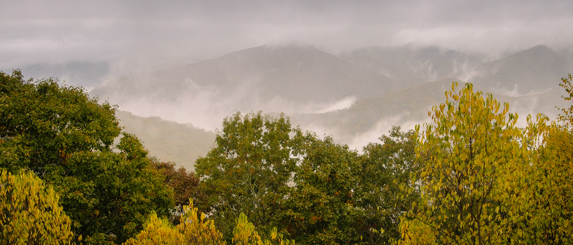
Moisture evaporating from the ground and low-hanging clouds lend their character to some of the peaks in the eponymous Great Smoky Mountains National Park. The US Congress chartered the park in 1934, and the park is managed by the National Park Service, which was created in 1916.
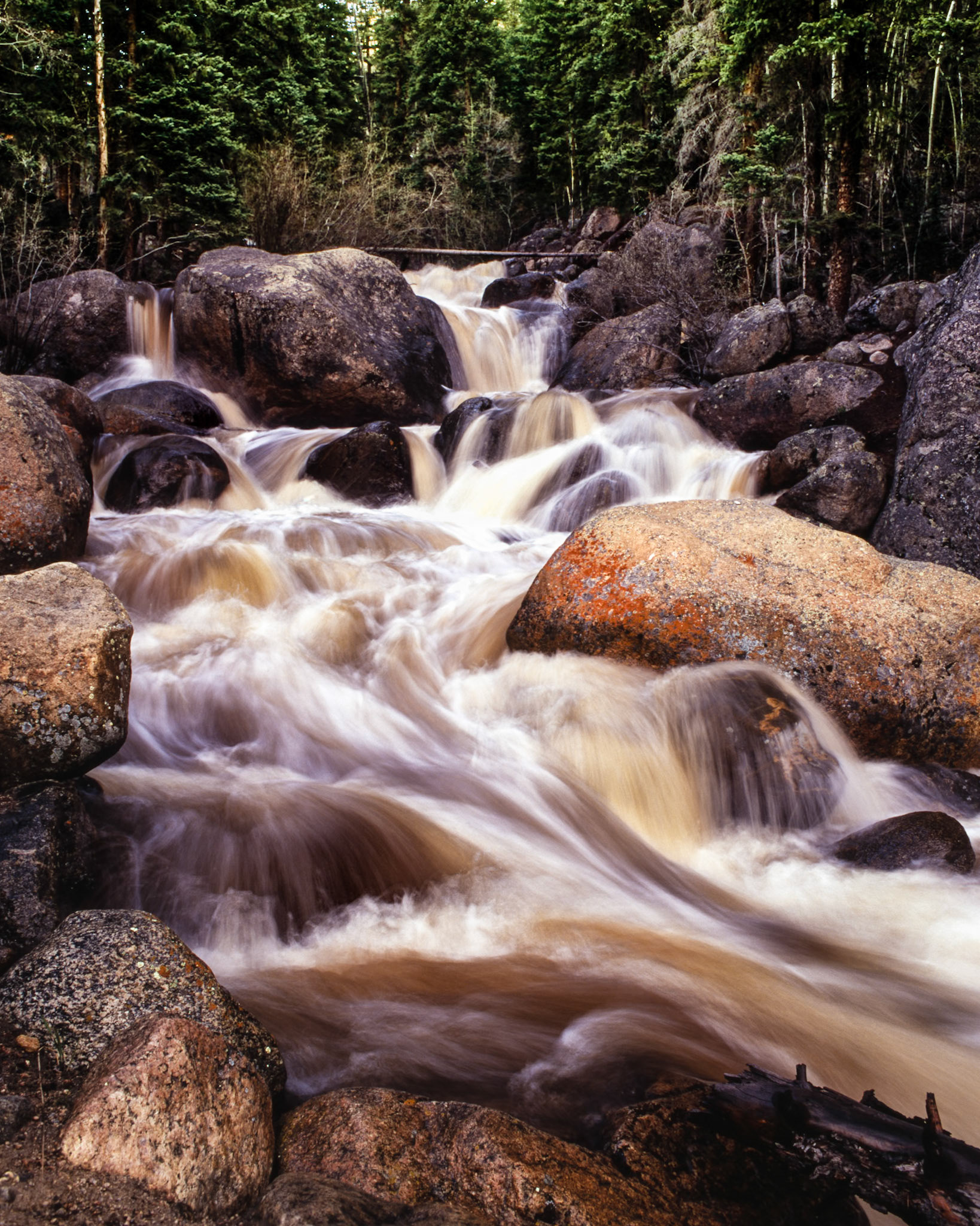
Scott Gomer Creek begins its approximately nine mile (15 kilometers) southward journey high on the slope between Grey Wolf Mountain and Mount Spalding. It is pictured here in the middle of its last 400 foot (122 meter) drop before joining Geneva Creek on its southward journey to the North Fork South Platte River.
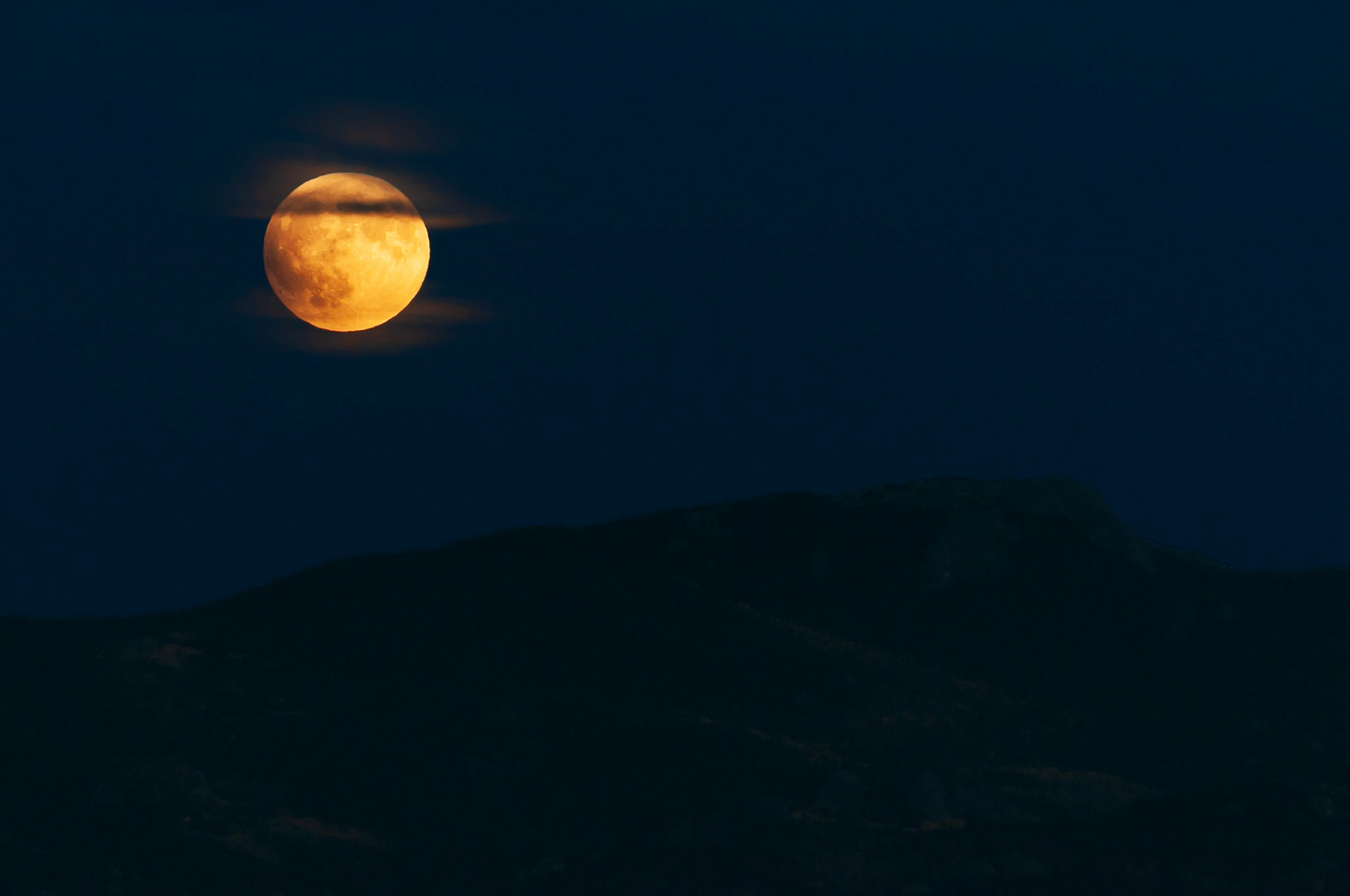
Shortly after rising above the Tarryall Mountains, which are located at the Eastern edge of the grassland basin known as South Park, some wispy clouds drifted in front of the Super Moon — this moon is also known as the Blood Moon and the Hunter's Moon — a few minutes before entering the umbra and its total eclipse on September 27, 2015.
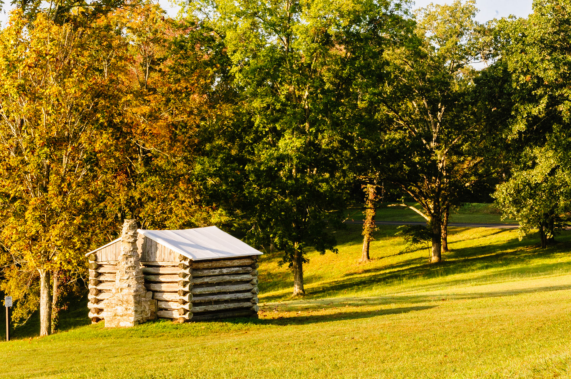
A single hut stands on the Fort Donelson National Battlefield where once there were many. Log huts like this were built both inside and outside the ten-foot earth and log ramparts of the American Civil War fort, and were used to house the artillery and infantry men who manned it.
While waiting for the Super / Blood/ Hunter's Moon to rise and located in the Northwest portion of the grassland basin known as South Park, the setting sun illuminated portions of the Continental Divide, the Kenosha Mountains and the Aspen trees on their slopes.
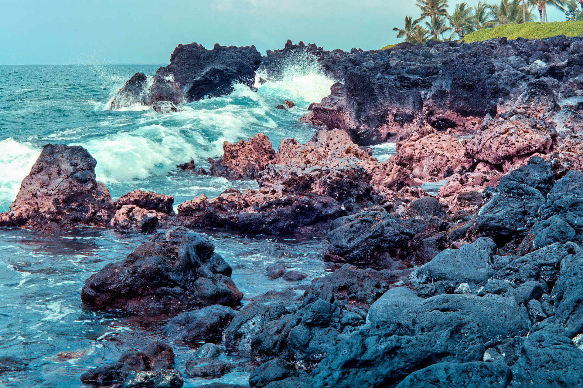
Waves break along the rugged coastline, remnant of ancient lava flows, located north of the Kamakahonu National Historic Landmark in Kailuna -Kona, Hawaii.Image captured on Kodak Royal Gold 100 color negative film. After scanning it with an Epson Perfection V750 PRO using Silverfast software, the ColorPerfect Plugin from CFSystems converted the negative image to a positive image in Photoshop. Post-processing completed in Lightroom Classic.
The West Elk Loop road (County Road 12) in Colorado connects Paonia State Park on the West end with Crested Butte on the East end. It passes between two wilderness areas (Raggeds Wilderness and West Elk Wilderness), which are located Southwest of the Maroon Bells-Snowmass Wilderness area, and crosses Kebler Pass at an elevation of 9,980 feet (3042 meters) in the West Elk Mountains.
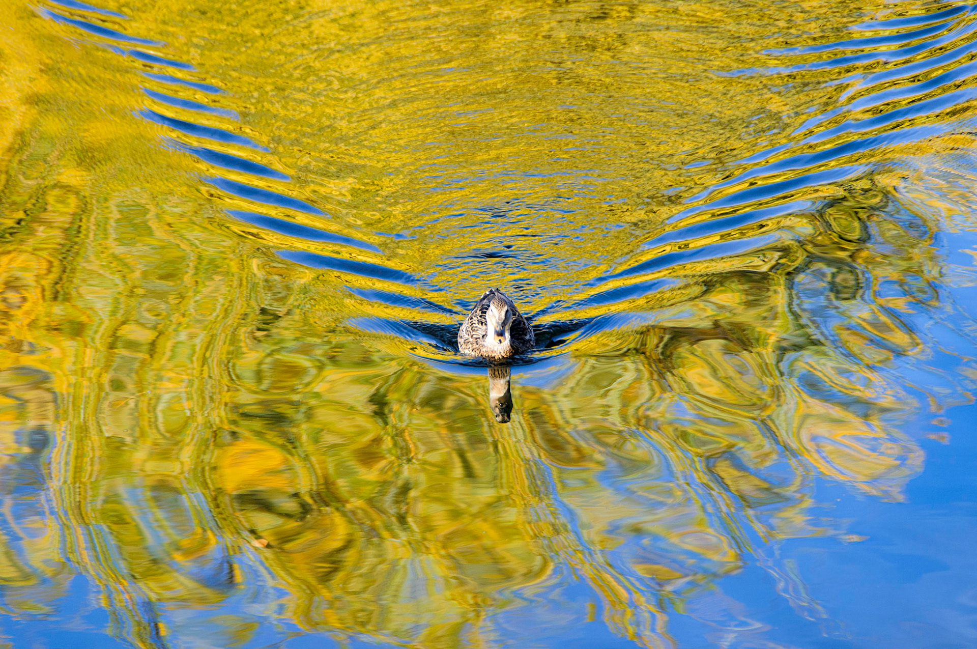
There is a small duck pond in a business park in Greenwood Village, Colorado that I’ve always wanted to photograph, and I was fortunate to arrive during golden hour on a beautiful autumn day in early November of 2010. The photo was made with a used Nikon D300 and kit lens purchased the month before, and it was this camera that made the decision to switch from 35mm film to digital easy.
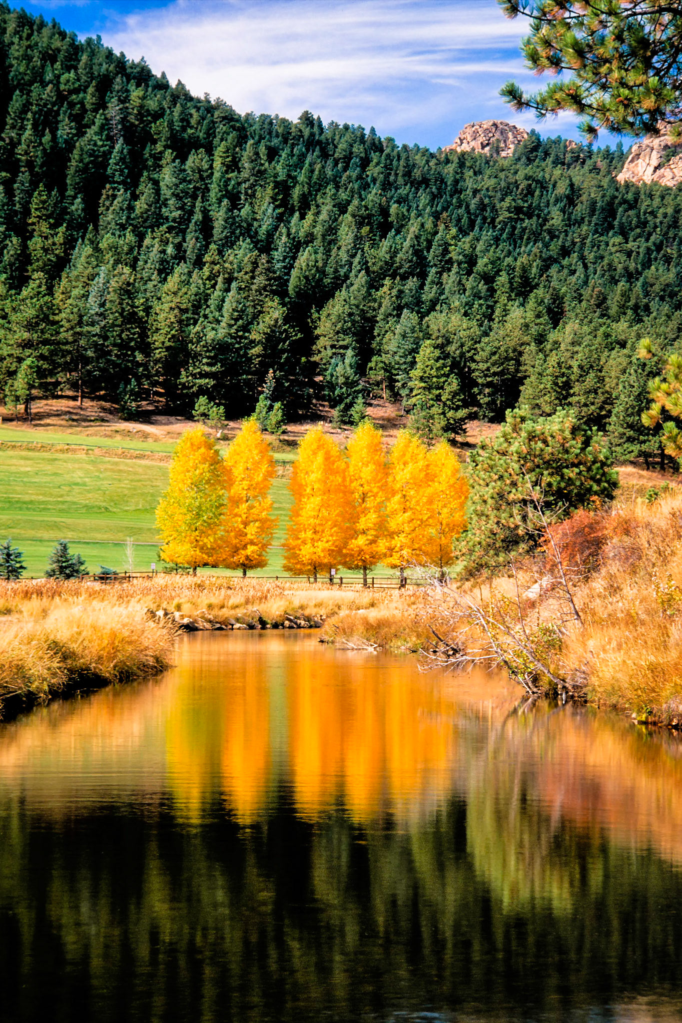
After meandering for several miles along the floor of Bendemeer Valley, and traveling past Rosedale and Troutdale, the waters of Bear Creek appear calm as they enter the reservoir that is Evergreen Lake, Colorado. The trees that line Dedisse Park and the Evergreen Golf Course glow brightly when lit by the early morning sun.